Your awe-inspiring 2026 journey starts here! Fixed Departures: Upper Mustang – 5th Aug, Annapurna Circuit – 8th Aug, 11th Sept, Nar Phu Valley – 24th Oct, 13th Nov


Kanchanjunga Trek
Trip Info
Duration
27 Days
Trek Region
Remote area
Destination
Nepal
Max. Altitude
5140m
Group Size
2 - 12
Grade
Demanding
Activity Per Day
5 to 7 hrs
Best Season
March to May and October, November
Activity
Trekking in Nepal
Start/End Point
Kathmandu / Kathmandu
People to name the three highest mountains in the world, and few get past Mount Everest and K2. At 8,586m, Mt. Kanchenjunga is only about 300 meters lower than Everest, but for all intents and purposes, the world’s third-highest peak been forgotten.
The Kanchenjunga trek, situated on the border between east Nepal and the Indian State of Sikim/Darjeeling. The mountain was first successfully tackled by British climbers in 1955, but they, like all who came after them, stopped just short of the summit out of respect for the locals’ belief that the mountain-top is sacred.
Mt. Kanchenjunga, a name that originates from Tibetan, means the “five treasures of snow” and corresponds to the massif’s five distinct peaks. Like many mountains in Nepal, Kanchenjunga trek offers world-class trekking.
But unlikely some of the country’s popular routes, which can become overrun in the high hiking seasons autumn and spring, the trails to and around Kanchenjunga’s two base camps remain delightfully free of visitors – likely due to the difficulty and expense of reaching the area.
Kanchenjunga is well off the established trail for trekkers and reaching a trailhead requires several days of road travel or a costly flight, due to its remoteness. In addition, trekkers must have permits and be accompanied by a recognized guide company.
The trekkers can choose one of two routes: to the South or north base camp. The trek to the 5,140m-high north base camp is longer, but offers more time in the high mountains. It’s also possible, over the course of roughly 22 days, to link the two routes via a couple of high passes.
The Kanchenjunga trek passes through small villages, patches of tropical forest and terraced fields. Crops vary depending on the altitude, with rice grown at lower levels and barley higher up. The big cash crop in the region is cardamom.
Most people travel with guide, porters and camping gear, but you can also stay in the teahouses. In popular trekking areas such as Annapurna, Everest and Langtang, teahouses cater almost exclusively to foreign trekkers and are increasingly sophisticated, even offering hot showers and Wi-Fi.
In the Kanchenjunga region, however, the teahouses are used mainly by local shepherds, traders and porters, and are simply villagers’ homes with a room or two for rent. Conditions can be basic – you’ll get a bed and a shared toilet – but staying in them allows visitors the chance to get to know locals in a way that’s rarely possible on more popular routes.
Kanchenjunga Trek Difficulty
The Kanchenjunga trek is a strenuous trekking grade. To finish the Kanchenjunga Base Camp Trek, you don’t have to be an athlete or peak dweller.
Again, it doesn’t mean walking in the Kanchenjunga region is as easy as walking or running in a park. Kanchenjunga (8,586m.) is the third highest mountain in the world, located in the far north-eastern corner of Nepal and shared by India and Tibet.
The isolation, dangerous trail, and this region’s vast diversity have made it one of Nepal’s restricted regions. So you need to get per
Our first close encounter with Kanchenjunga. Following the valley round to see the stunning south face of Kanchanjunga and Jannu.
We get across the Yalung Ri Glacier and continue by a sweeping curve, at Oktang, 4730meters, suddenly we are confronted with the southern wall of the mountain.
This vast ridge forms a cirque over 15 kms long, nowhere less than 7500meters high and with three main summits of Kanchenjunga at 8420meters, 8586meters, and 8474meters!
It is a breathtaking mountain panorama and especially impressive is Jannu while observing the glaciers flowing from its east face.
mit from the Nepal government to go on a trek to this region. The trail includes difficult passes, valleys, rocky paths, wild rivers of glaciers, and dense forests.
Two of the best and most popular routes are also difficult and require technical climbing. It doesn’t mean you can’t complete this trek, however; proper acclimatization and professional guidance can make the trip a success.
Note
The above information is a guide and standard template of what we provide. This itinerary can be customized according to the duration of your holiday. We have many options for shorter visits based on your interests and budget.
On an adventure trek of this type, weather, political strikes, transport or a multitude of other factors beyond our control can result in a change of itinerary. It is however very unlikely that the itinerary would be substantially altered; if alterations are necessary the leader will decide what is the best alternative, taking into consideration the best interests of the whole group. Where a change does occur, we do everything we can to minimize its effect, but we cannot be responsible for the results of changes or delays.
Trek Leader and Crew
Here at Himalaya Discovery, we firmly believe that the way to get the most out of your staff is to treat them well; a happy staff is a hard-working staff. And this belief manifests itself in every way we deal with our staff.
We employ only local leaders and staff to help sustain the local communities we work with. We provide training for all our staff and all our trek leaders are trained in the following as a minimum;
- Intensive Wilderness First Aid
- Trekking Guide Training
- Eco Trekking Workshop & Adventure Meet
- English Language
- Conservation & Biodiversity
- Rock & Ice Climbing & Mountaineering (for expedition leaders)
So, we can guarantee you your trip will be led by the best, most professional and experienced guides there are. All of our guides good English-speakers, All our guides are carefully selected for their experience, leadership skills and personal ability. We have learnt that effective leadership is a vital for a trip to be safe, enjoyable and successful.
In fact, not only are all our guides experienced working in these regions, but most of them actually grew up in these mountainous regions of Nepal. Its home for them, it’s in their blood. They’re not only ‘familiar’ with local communities and culture; they’re a part of them and they practice it. They truly love their home and relish getting the opportunity to show travellers.
Itinerary
Day 01- Arrive in Kathmandu.
Upon your arrival in the Kathmandu airport after completing your custom formalities Visa,etc. pick up your luggage and look for our airport representative from Himalaya Discovery, who will display your name on the board at the arrival gate.
You will be greeted by our representative and transferred to the your hotel by private tourist vehicle. Overnight in Kathmandu.
Altitude : 1400m
Day 02- Free in Kathmandu for sightseeing and pre trip briefing and gear check.
Today is free for sightseeing in Kathmandu. You may wish to visit Durbar Square in the heart of the old city where the old Royal Palace, with its intricate woodcarving is located. The whole area is a maze of temples and images. Leading away from the square in all directions are narrow alleys, full of the most amazing variety of shops and stalls.
Some of these landmarks are considered World Heritage Sites including the historic Bhaktapur Durbar Square, the famous ‘Monkey Temple’ Swayambhunath and Buddhists shrine Buddhanath which is one of the largest Stupas in the world.
There will also be a full trip briefing today with gear check. In case you need to hire or buy equipment locally there will be time to do this today. Overnight in Kathmandu.
Day 03- Fly to Taplejung and trek to Lali Kharka.
Half hour flight to Taplejung at Suketar Airport. The porters and crew will be waiting for our arrival. After landing we take an early lunch, while the crew arranges our gear. In the afternoon we start with an easy 2 to 3 hours walk along the ridge line to Lali Kharka, a grazing area.
Duration : 3 hrs
Altitude : 2276m
Day 04- Trek to Khesewa.
After traversing the hillside a short way, we descend to the village of Pakora along the Phawa Khola, crossing a suspension bridge before beginning the steep climb up towards Kunjuri.
Lunch will be taken somewhere below Kunjuri. The afternoon’s walk takes us on a short distance over the crest of the ridge to our campsite at Khesewa.
We get our first views of Kanchenjunga, and should be able to clearly make out the south and main summit along with Yalung Kang.
Duration : 5 hrs
Altitude : 2120m
Day 05- Trek to Mamankhe.
Today the path covers steep hillside through terraced fields high above the Kabbeli Khola. There are some ups and downs crossing side valleys but there are many shady spots to rest.
After lunch, we pass the village of Anpan, before descending to cross the Kashawa Khola and finally, we climb again through terraced fields to the village of Mamankhe.
Duration : 5 hrs
Altitude : 1920m
Day 06- Trek to Yamphudin.
Today the walk start with an easy climb to Yamphudin along a track which contours the hillside above the Kabeli Khola. The path has several ups and downs as we cross the ridges and stream beds that make up the valley sides.
Generally the route is flat and the river eventually becomes level with the trail, a couple of hours before Yamphudin. At last we can stop to bathe in one of the clear pools within this beautiful river. It is truly an idyllic spot.
After lunch by the river we complete the day’s walk to Yamphudin. Yamphudin is the most remote settlement in this area and the last village we will see until we reach Ghunsa. It is a charming place tucked away beneath the ridge of Deurali Danda that we must cross next.
Duration : 6 hrs
Altitude : 2080m
Day 07- Trek to Chitre.
Beyond Yamphudin the trail ascends a steep spur, a gentle introduction for what will come. Leaving villages behind we trek through pleasant forest, stopping for lunch in a meadow capturing fine views of the north and south.
A steep descend to the river an interesting bridge across the Omje Khola to our campsite in Chitre.
Duration : 5 hrs
Altitude : 2965m
Day 08- Trek to Tortongn.
Starting the day with 3 hours of steep ascent to the crest of the Deurali Danda in dense forest most of the way. From the 3230meters pass we see Jannu, definitely closer!
We descend across some steep and exposed areas before entering the forest again. The sharp descent through beautiful forest continues down into the valley of the Simjua Khola.
Across the ‘interesting’ wooden bridge is Tortongn, a camping place with numerous rock shelters amid towering conifers. The steep hills make today a tough 6 to 7 hours trekking.
Duration : 6 hrs
Altitude : 3010m
Day 09- Trek to Tseram.
Today we follow the river through more beautiful forest, the conifers giving way to the rhododendron forest.
The valley climbs fairly steeply, with the day progressing the trees become more stunted and scattered, giving us glimpses of the snow-capped giants ahead and the massive snout of Yalung Glacier.
Just before Tseram the towering heights of Kabru and Rathong peak start to peep over the moraine. Camping at Tseram, a grazing area, the night temperatures will remind us that we are really gaining height.
Duration : 6 hrs
Altitude : 3870m
Day 10- Trek to Ramche.
A shorter day’s walk up the final 600 meters to Ramche where the trail to Kanchenjunga South turns dangerous.
The scenery is magnificent as we ascend past the snout of Yalung Glaciers into a series of ablation valleys, which gives easy walking and good camping.
A frozen lake, clear streams and views of Koktang, Rathong and Kabru are the highlights of this stroll. Expect to feel the altitude today.
Duration : 4 hrs
Altitude : 4580m
Day 11- Discover around Ramche and trek to Oktang.
Our first close encounter with Kanchenjunga. Following the valley round to see the stunning south face of Kanchanjunga and Jannu.
We get across the Yalung Ri Glacier and continue by a sweeping curve, at Oktang, 4730meters, suddenly we are confronted with the southern wall of the mountain.
This vast ridge forms a cirque over 15 kms long, nowhere less than 7500meters high and with three main summits of Kanchenjunga at 8420meters, 8586meters, and 8474meters!
It is a breathtaking mountain panorama and especially impressive is Jannu while observing the glaciers flowing from its east face.
Duration : 5 hrs
Altitude : 4730m
Day 12- Trek to Yalung Ri Base Camp.
This extended part will take you to the high altitudes. It requires determination. The crossing of high passes requires good weather, and of course perfect logistic support. Expect to get acclimatized with the altitude today.
Duration : 5 hrs
Altitude : 4580m
Day 13- Trek back to Ramche.
Yalung Glaciers and a series of valleys, give good walking and perfect camping. A frozen lake, clear streams and magnificent views are the highlights of this stroll.
Duration : 5 hrs
Altitude : 4580m
Day 14- Trek to Sele La over the Margin La.
We trek down the valley, passing the turn off to the high and challenging Labsang La route to Ghunsa and the north side of Kanchenjunga.
This pass is rough and dangerous, especially for porters so we take the more southern set of passes, beginning with the Mirgin La. After an initial steep climb and several false summits we reach Mirgin La.
Apart from the magnificent Jannu, on the horizon are Makalu, Gyakung Kang, Everest, Lhotse and Chamalang. To the south it is possible to see down to the Terai, a panorama worth the effort. Our campsite will be beyond the pass, after 6 to 7 hours tough walking.
Duration : 6 hrs
Altitude : 4480m
Day 15- Trek to Ghunsa.
Although there four more passes, there is little descent between them, so in effect it is a high scenic area. After lunch the descent brings us to Lamba Sumba Kharka, where there are more views of the awesome Southwest Face of Jannu.
From Kharka the going is easy again down a pleasant forested trail to the village of Ghunsa, where we camp in the village. Ghunsa is a picturesque Tibetan village; prayer flags flutter from the wooden houses and there are two monasteries, a welcome sight after the many days of wilderness.
One of the local specialties’ is ‘Tongba’, a curious alcoholic drink. A jug or large bamboo cup is filled with fermented millet seed and boiling water pored over. The flavour and alcohol seep though and you drink it with a special straw. You might need a drink after the tough 4 to 6 hour walk.
Duration : 5 hrs
Altitude : 3475m
Day 16- Trek to Kambachen.
Gradually the trail ascends to south of the Ghunsa Khola and crossing flood plains while emerging on a pasture situated at the north side of the river.
A steep climb to a slope from where it crosses a slide and then descends to Lakepo. A short climb from here to the village of Kambachen 4040 meters.
Duration : 6 hrs
Altitude : 4040m
Day 17- Discover Kambachen.
Today, we spend acclimatizing to high altitude. It also doubles up as a rest day and can be used for a short morning hike to explore the area around Kambachen.
Those who feel the urge should be able to catch up on their laundry. Otherwise, a good book should get you through the day perfectly. It is essential to acclimatize to the higher altitude as you have been spending a lot of time at lower altitudes.
From here there are good mountain views of the peaks near Kanchenjunga which are visible. You can hike up the ridge above the village for better views or take a day hike to Jannu Base Camp. The Nepali name for Jannu is Kumbakarna.
Day 18- Trek to Lhonak.
A gradual climb through rocky fields gets you to Ramtang at elevation of 4240 meters then crossing northwest of the Kanchenjunga Glacier you reach Lhonak.
Lohnak is on a sandy plain near a dry lakebed. You will camp between the boulders here to stay out of the wind. There are beautiful mountain vistas all around. Water is very scarce in Lhonak and you will need to use only as much as absolutely necessary.
Duration : 6 hrs
Altitude : 4790m
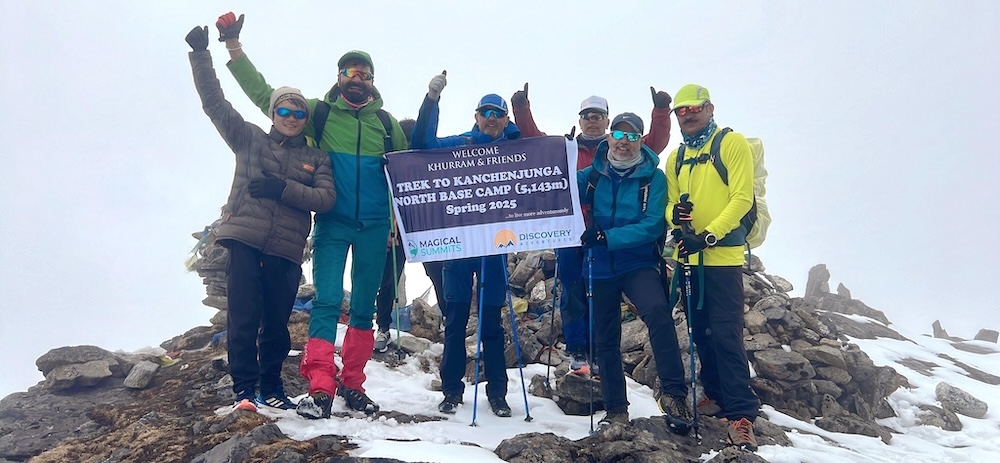
Day 19- Trek to Pang Pema.
The main Kanchenjunga peak is only visible from Pang Pema, which is the base camp for expeditions on Kanchenjunga.
From Lhonak, the trail gradually ascends across the plain but soon gets steeper as it follows the moraine. Pang Pema is at a height of 5140 meters.
Duration : 4 hrs
Altitude : 5140m
Day 20- Discover around Kanchenjunga Base Camp and retrace your steps to Kambachen.
Today those who would like to take a morning hike up a ridge, north of Pang Pema. A climb of 200 or 300 meters providing a great vantage point with views of Kanchenjunga, Wedge Peak, the Twins and Tent Peak.
As usual the descent goes faster and you can reach Kambachen the same day.
Day 21- Trek to Ghunsa.
More descents thru magnificent sections of forest as long as we make Amjilosa tomorrow.
From Ghunsa an hour down we pass through Phole, a village in two parts. The upper section houses Tibetan refugees who are well established, the second is the winter village of Ghunsa. Further down is Yangswa, a great and warm camp.
Duration : 6 hrs
Day 22- Trek to Amjilosa.
Initially, we pass through beautiful forest opening out to steep, grassy hillsides where Amjilosa is perched. Overnight at tented camp.
Duration : 4 hrs
Altitude : 2460m
Day 23- Trek to Sakathum.
Down, down and down! After a short climb we begin the steep descent that will take most of the day. We reach the joining of the Tamur and Ghunsa Kholas.
Duration : 5 hrs
Altitude : 1600m
Day 24- Trek to Chhiruwa.
We cross the Simbu Khola, which originates from Kanchenjunga’s south base camp, the Khola that we followed up from Torontan.
It is pleasantly warm at these low altitudes and cardamom grows freely in the moist shaded forest. Crossing numerous small tributary streams we reach Chhirwa, a village set among large boulders. We camp in a field out of the village. This is an easier day.
Duration : 5 hrs
Altitude : 1200m
Day 25- Trek to Suketar.
Traversing in an out of minor valleys, we pass thru a succession of picturesque villages on our way to Suketar, reaching around late afternoon.
Duration : 5 hrs
Altitude : 2420m
Day 26- Fly to Kathmandu.
Enjoying your last glimpse of the mountains you have recently visited one last time on the 35 minute Scenic flight back to Kathmandu.
On arrival in Kathmandu we are met and transferred back to hotel. Overnight at hotel in Kathmandu.
Altitude : 1400m
Day 27- Free day / Fly to home.
Today is rest and relax throughout the day. If you get interested to take some gifts from Nepal for friends and relatives, visit to some nearby shops or go out in Thamel for typical Nepalese goods.
In the evening we will have a farewell dinner in a traditional Nepalese restaurant with cultural performances. Overnight in Kathmandu.
Day 28- Fly to home.
The trip concludes! We will drop you to the airport for your flight departure from Nepal.
Not Satisfied with the Itinerary? We can customize a personalized itinerary to suit your preferences and requirements, ensuring your trip is exactly how you envision it.
Price Includes
- Airport transfers pick-up and drop-off
- All necessary paper work for the special Kanchanjunja trek permit & Conservation entry permit.
- Trekking information management system (TIMS) permit.
- Surface Transfer to and from Kathmandu by private car / bus / Jeep.
- Full board meal (breakfast, lunch, dinner) during the trek.
- A government licensed Sherpa guide & a cook during the trek.
- Boiled and purify drinking water for the trek.
- Airfare both ways Kathmandu – Taplejung – Kathmandu.
- The required number of staff and Porters to carry your luggage during the trek (1 porter for 2 trekkers).
- Accommodation / salary / food / drinks / insurance / equipment / medicine and transport for all staff.
- Sleeping bag and walking stick (if it is required).
- All government taxes.
- Farewell dinner with culture show.
Price Excludes
- International airfare and Nepal visa.
- Tips for the guide / porters (tipping is expected).
- Travel insurance which covers emergency Rescue and Evacuation.
- Any others expenses which are not mentioned on the ‘Price Includes’ section.
Join our Fixed Departure Group Trips
Our fixed group tours are thoughtfully scheduled and offer specific departure dates, providing a fantastic opportunity for both solo traveler and groups to come together. Join other guests on a memorable journey and share in the adventure of a lifetime!
Ready to create your perfect adventure? Use our trip planner to customize your itinerary and schedule according to your preferences. We’re here to help you tailor every detail to fit your unique needs.
Beautiful memories KBC Trek!
I was part of a group of 5 who booked the Kanchenjunga North Base camp trek through Himalayan Discovery Adventures. I was very impressed by the level and speed of service which was extended from the time I started conversation with booking team till the time I ended the trek. The guide was superb, knowledgeable of the trek and was very courteous. The support team back in Kathmandu led by Mr. Chhiring Sherpa went out of their way to make the experience of this amazing trek even more memorable. Not only would I recommend Himalaya Discovery Adventures to others but I would look them up again for my future treks in Nepal.
An Unforgettable Journey on the Indigenous People’s Trail – Perfect for Every Adventure!
Great trekking company
My 80 year old father and myself did the Indigenous People’s Trail with Himalaya Discovery. They were absolutely wonderful!!! All communications with Chhiring Sherpa when we were still in Aus were clear and accurate. He made the planning very easy. Once we got to Kathmandu our guide met us at the airport and made the rest of our trip a piece of cake. They shaped the walk around what we wanted, were able to tailor each day’s walk to what suited best at the time. Lots of time spent with locals, eating and drinking with them for their evening dinners. Great people to be walking with. I will definitely be coming back and using this company every time I come here.
Une Aventure Inoubliable au Népal avec Himalaya Discovery – Authenticité et Bienveillance au Rendez-vous!
Deux copines venues de très loin pour fêter les 30 ans. Le défi de Thorong La était quelque chose d’assez incroyable et stressant pour nous. 2 filles. Mais, HIMALAYA DISCOVERY (même entreprise que MAGICAL SUMMIT) est selon moi l’entreprise la plus locale et sincère que l’on peut trouver au Népal. C’est l’entreprise qui vous donne la force de réussir ! ????️
Ils ont une dizaine de guide/porteurs maximum.
Tindu et Pemba étaient si bienveillants , calmes et au petit soin chaque jour. Nous avons passé 10 jours exceptionnels. Ils sont devenus notre deuxième famille et c’est une certitude que nous reviendrons au Népal avec eux.
Chaque détail était important pour eux. Notre bien être , leur priorité. La réservation des meilleures chambres dans les maisons de thé. Nos meilleurs repas pour l’acclimatation et bien dormir.
Nous rassurer quand nous étions un peu inquiète d’une étape de marche.
Une flexibilité hors norme, même sur place lorsque nous avons voulu modifier quelque chose.
Vraiment je ne peux pas recommander une meilleure agence que celle là.
Vous pouvez y aller les yeux fermés.
Ce sont les meilleurs.
Ce sont les plus sympathiques.
Mais surtout : les plus authentiques.
Merci encore à mes amis népalais.
À bientôt
Laura de Corsica.
Recommended for you
View Details
Trekking in Nepal
Dhaulagiri Circuit Trek
View Details
USD 1,985
Trekking in Nepal
Upper Mustang Trek
View Details
Trekking in Nepal
