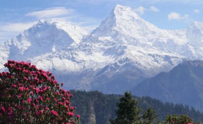
Have you ever dreamt about standing on the top of the world? Do you have the right ingredients and experience? If your answer is yes! Hurry up! The most popular choice among the mountaineers for Everest expedition is via the South Col which gives the most assured means of reaching the top.
Time spent over 8000 m is less on the south side in approaching the summit as the summit is attempted in one push. In addition, the South route has a good record of success due to the easy access of the route once it is opened by the season’s first summits.
The admired Everest expedition trail is followed to reach the base camp for the Mt. Everest expedition. A short walk along the moraine leads to the icefall with large crevasses which are considered one of the obstacles for the expedition.
Our fully experienced Sherpa expedition teams is fixing this section with ropes and ladders, making it easier for climbers to cross this section to reach Camp 1. The terrain is gradually climbing to Camp 2.
A mixed snow and ice climb leads up the Lhotse Face to Camp 3 from here. From camp 3 it is not easy to climb on moderate mixed snow and rocks which leads to the Camp 4 South Col.
The route steepens to reach the South East Ridge crest and easy climbing after ascending snow slopes and then steep climbing again leads to the South Summit. A short crossing to the Hillary Step and then climbing on the notorious Hillary Step’s short steep rock and snow groove leads up to the summit’s final ridge.
Experience Required for Mt. Everest Expedition
The most required factor on our ‘Himalaya Discovery Everest Expedition’ is that the participants must have a solid understanding of mountaineering skills. This should include previous high altitude experience of at least 6,000 meters, mixed with a multitude of Alpine mountaineering and, preferably, you will have taken part in a previous 8,000-meter expedition.
Please let us know if you want us to arrange training program in some of the 6000 and 7000 meters peaks in Himalaya before your Everest expedition begin. Our three Peaks Climbing courses or Pumori Expedition is appropriate for preparing Mt. Everest expedition.
Based on our experience, we found that those who had previously reached a peak of 7000 to 8,000 meters had a considerably better chance of reaching the top of Everest. Before going to Everest, we will strongly advise you to climb one of the other 7000 or 8,000 m peaks, as this is the best way to ensure that the money you spend on Everest is rewarded with a successful ascent and a safe return home.
Exceptionally, however, climbers who have not had the ability to climb a peak of 7000 to 8,000 m may find Everest if they have a compensating depth of experience.
Although fixed ropes will be used where necessary, members of the expedition must have the ability to climb Alpine routes. All members of the team must be professional mountaineers and self-sufficient with the ability to move between and stay in unassisted or supervised High Mountain camps.
Our Everest expeditions are professionally led by teams of competent mountaineers Sherpa who each have enough experience to climb the world’s highest mountain, under the supervision and leadership of one of most accomplished and experienced high-altitude Sherpa leaders.
Upon your arrival in the Kathmandu airport after completing your custom formalities Visa, etc. pick up your luggage and look for our airport representative from Himalaya Discovery Adventures, who will display your name on the board at the arrival gate.
You will be greeted by our representative and transferred to the hotel by private tourist vehicle. Overnight in Kathmandu.
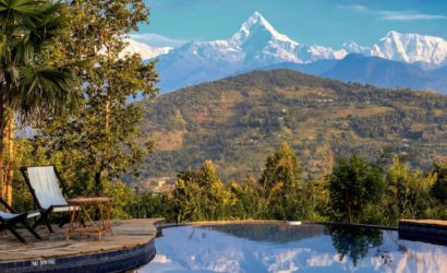
Today is free for sightseeing in Kathmandu. You may wish to visit Durbar Square in the heart of the old city where the old Royal Palace, with its intricate woodcarving is located. The whole area is a maze of temples and images. Leading away from the square in all directions are narrow alleys, full of the most amazing variety of shops and stalls.
Some of these landmarks are considered World Heritage Sites including the historic Bhaktapur Durbar Square, the famous ‘Monkey Temple’ Swayambhunath and Buddhists shrine Buddhanath which is one of the largest Stupas in the world.
There will also be a full trip briefing today with gear check. In case you need to hire or buy equipment locally there will be time to do this today. Overnight at hotel in Kathmandu.
Today, the expedition leader will also check everyone’s equipment. The last opportunity to buy anything missing, Overnight at hotel.
An early morning start takes us to (TIA) Airport in Kathmandu for the 35 minute scenic flight to Tenzing and Hillary Airport at Lukla at 2804meters. On arrival at the airport guide will brief you and introduce our porters before we begin our trek towards Phakding.
After landing we have time to discover the village while our staff sort and load our trekking equipment. Then we begin our trek by descending towards the Dudh Kosi River where we join the main trail to Namche Bazaar, located just above Chaunrikharka (2713 meters).
The walking is easy and after passing through the small village of Ghat (2550 meters) it is a short walk to Phakding,It is important to take these first few days slowly to enable your body to acclimatize and to enjoy the passing scenery and culture. Overnight at guesthouse.
We continue trekking along the banks of the Dudh Kosi, crossing this majestic river many times on exciting suspension bridges laden with prayer flags. After entering Sagarmartha National Park, the trail climbs steeply with breathtaking views.
Namche Bazaar known as the Gateway to Everest which is home to many quality restaurants, hotels, lodges, shops, Money exchange, internet cafe and a bakery. Namche is one of the biggest villages along the whole Everest trail. Overnight at guesthouse.
We will spend a day here in order to acclimatize and adjust to the thinning of the air. As well as a short trek where a museum is celebrating the traditional customs of the Sherpa people.
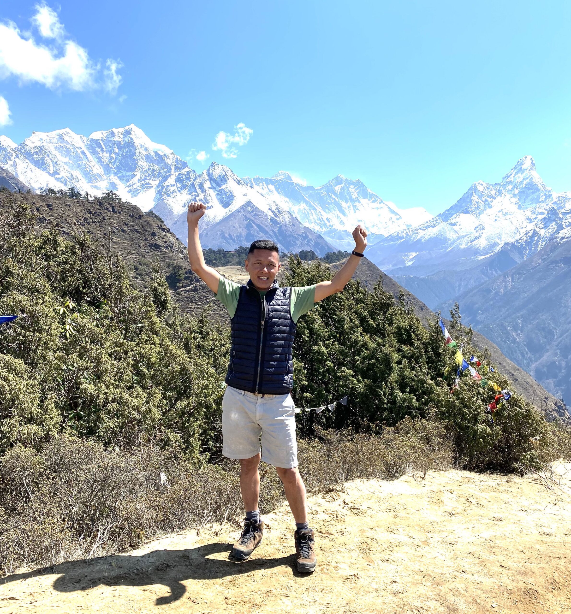
Today we hike up the Syangboche Airport around Everest View Hotel. From this point, we can see rewarding views of the Himalayas with a stunning sunrise and sunset over the panorama of Khumbu peak. Overnight at guesthouse.
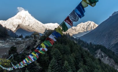
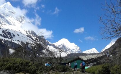
The trek continues along the rushing glacial waters of the Dudh Kosi with magnificent views of the mountains. We trek to an altitude of 3860 meters today. On reaching Tengboche you will see the local monastery.
Inside the monastery are incredibly ornate wall hangings, a 20-foot sculpture of Buddha, and the musical instruments and robes of the Lamas.
The group will be taken to observe a prayer ceremony either in the evening or morning depending on how the days trekking went. Overnight at guesthouse.
From Thyangboche the trail drops to Debuche, crosses another exciting suspension bridge on the Imja Khola, and climbs to Pangboche amongst thousands of mani stones.
Our uphill trek continues, taking us to the quaint traditional Sherpa village of Dingboche with its exquisite views of Lhotse, Island Peak, and Ama Dablam. We take our time so we avoid getting affected by the altitude. Overnight at guesthouse.
Today, you can enjoy another day for acclimatization. We will have trip to Chhukung valley via the Imja Khola valley to get a marvelous view of the surrounding mountains, especially Lhotse massive south wall, then return to Dingboche in the evening. Overnight at guesthouse.
Today, the trail continues along the lateral moraine of the Khumbu Glacier and passes by stone memorials for climbers who have perished on nearby summits.We continue to climb as we are heading to the altitude of 4910meters at Lobuche which is really just a few huts at the foot of giant Lobuche peak. Some breathing problems may arise today due to the altitude. Overnight at guesthouse.
Most of this day is spent climbing Mt. Kala Pattar, a small peak (by Himalayan standards) at 5555 meters. The ascent is demanding but the climber gets the most magnificent mountain panorama possible: Everest, the highest point on the planet at 29028 ft, 8848 meters, towers directly ahead and on all sides loom the other giants, Nuptse, Pumori, Chagatse, Lhotse and countless others.
If possible we can stay and watch the awe-inspiring sunset on Everest and its neighbours. We make a quick descent to Gorak Shep, a tiny hamlet at 5180 meters. Overnight at guesthouse.
Contouring along the valley side, the trail leads on to the moraine of the Khumbu Glacier and becomes quite vague, weaving between mounds of rubble. After about 4 hours we will eventually reach base camp near the foot of the Khumbu Icefall. This will be our home for the next couple of weeks. Overnight at tented camp.
We set about acclimatizing and learning the specialist skills needed for the mountain, such as how to use the oxygen and the radios. We will also hone our equipment and clothing requirements for the mountain, and set aside the food we want to eat in the upper camps (as this will be pre-placed for us by the Sherpa.)
In between times, we rest and get used to the altitude without undue exertion, as experience has shown this is the best way to prepare. We aim to make base camp as comfortable as is reasonably possible, with a heated, triple-skin mess tent, individual tents for each climber to sleep in, broadband internet connection and satellite telephones.
Before venturing into the Khumbu Icefall, we will practice secure movement through complex ice terrain including the use of the ladders and fixed rope. We do this locally, in base camp and on the ice columns found at the lower edge of the icefall.
As soon as the route through the Icefall is prepared and after the training in base camp, we will have our first go at the icefall, with the aim of getting halfway through and back in time for mid-morning in base camp. Then, we will progress higher until we know we can get through the icefall and all the way to Camp 1 in a reasonable time.
Whilst we are getting accustomed to the ropes, ladders and altitude, the Sherpas will be running loads through the icefall, into the Western Cwm and beyond.
Camp 1: 20996ft. (6,400meters.)
The camp 1 is situated at an elevation of 6400meters on horizontal area of deep snow covered by mountain walls. The area is warm due to sun’s reflection during the day and in the night we happen to listen the deep murmuring cracking sounds of crevasses beneath our tent.
Camp 2: 22145ft. (6,750meters.)
Camp 2 is set at the foot of the icy Lhotse wall at an altitude of 6,750meters. Cloudy but can expect pleasant weather here.
Camp 3: 23292ft. (7,100meters.)
Camp 3 is based at the height of 7100meters and this place is adjacent to Lhotse wall at 1220meters, which can be ascended using fixed rope and we eventually reach camp 4. On the way to camp 4, climbers need to go through the steep allow bands (lose, down -slopping and rotten limestone). As we cross short snowfield, the route takes them up the Geneva Spur to the east before finishing the flats of the south col. Beyond camp 3, some climbers may possibly feel minor discomforts necessitating use of oxygen.
Camp 4: 27560ft. (8,400meters.)
This is the last camp of the Expedition which is placed at the height of 8,400meters. This is considered as the risky part of the climbing from where the summit is not far than 450meters. The Narrow South – East Ridge is taken as the normal best way to attain the South Summits 8,750meters and from here it is easy to reach at the summit of the Everest 8,848meters.
The Climb
From base camp, the route to the summit can be divided into four separate sections:
The Khumbu Icefall
The Western Cwm
The Lhotse Face
The Summit (South East) Ridge
The Khumbu Icefall
The Khumbu Icefall is an icefall at the head of the Khumbu Glacier. The icefall is found at 5,486 meters (18,000 feet) on the Nepali slopes of Mount Everest not far above Base Camp and southwest of the summit. The icefall is regarded as one of the most dangerous stages of the South Col route to Everest’s summit.
The Khumbu glacier that forms the icefall moves at such speed that large crevasses open with little warning.
The large towers of ice or seracs found at the icefall have been known to collapse suddenly. Huge blocks of ice tumble down the glacier from time to time; they range in size from cars to large houses. It is estimated that the glacier advances three to four feet (0.9 to 1.2meters.) down the mountain every day.
A mountaineer traversing a ladder in the Khumbu Icefall. Since the structures are continually changing, crossing the Khumbu Icefall is extremely dangerous.
Even extensive rope and ladder crossings cannot prevent loss of life. Many people have died in this area, such as a climber who was crushed by a 12-story block of solid ice.
Exposed crevasses may be easy to avoid, but crevasses buried under snow can form treacherous snow bridges through which unwary climbers can fall.
The Western Cwm
A walk into the Western Cwm is to walk into the hall of the mountain gods. It is an awesomely impressive and inspiring place. Gigantic walls tower over you as you move from Camp 1 towards the full expanse of the Cwm above, with the West Ridge of Everest to the left, and the North Face of Nuptse to the right.
Here, the Cwm is at its narrowest, and you will find some gaping crevasses across the floor even though the ground is relatively flat. They’re so big everyone measures these holes in terms of double-decker buses!
But that either means the crevasses need to have ladders stretched across them, which gives easy access (if not goggled-eyed) to their upper sides, or they have to be walked around.
Either way, they add to the sense that having passed through the labyrinth of the icefall; the gods have set one more task for you to pass, before they’ll let you into their inner sanctum.
This final test usually includes at least one steep wall of ice, which rises straight from the floor to give a vertical step of about 30 meters. / 100ft and so to the hallowed ground of the upper Western Cwm.
From here, with the gods gazing down from the mountain’s upper ramparts, easy (but perhaps exhausting) progress is made to reach Camp 2, nestled below the West Ridge, just short of the foot of the South West Face.
The Lhotse Face
Early in the season, when the face is still unfettered by human steps, this steep section makes for the most grueling and technically intricate day on the mountain. Gusting winds, snow plumes, and the sight of the steep face above greet you at the base of Lhotse after a steady morning walk to the very end of the Cwm, above Camp 2.
Careful footwork will have you ascending this section confidently where the laser-straight ascent, which rises on a slope that seems to touch your nose is in stark contrast to the zigzag maze of the icefall below.
Arrival in Camp 3, halfway up the Lhotse Face, gives you a truly rugged, high mountain experience. Platforms, cut just wide enough for the tents, will have been hewn out of the bullet-hard ice by the Sherpas ahead of your arrival. But once that work has been done, it’s a mass exodus of our Sherpas back down to the comforts below.
The Sherpas play by Sagarmatha’s rules and for them, a night on these exposed ledges is frowned upon by the mountain gods. Well that’s what they say, but if it only takes an hour or so to get back here, and you can be ready for work before the team’s climbers have even risen for breakfast, why wouldn’t you take your rest lower down?
For those with slower legs (but seemingly normal hearts and lungs), we settle here on our ledge for one of the most glorious sunsets seen by any human in all time (save the Apollo Astronauts, perhaps!)
Typically, our camp is pitched in the lower neighborhood of camp 3 (which can sprawl over several hundred meters up the slope) affording us better shelter from the wind than some of the tents perched above.
And, after a night of re-hydration and an initial round of oxygen-rich sleep, it’s a return to base camp and then all the way off the mountain to Dingboche before you return here just once more, on the way to the top.
Next time, when we leave Camp 3 at 7,400meters, you will be gripped by the first flush of true summit fever; down-suits donned, Top Out masks fitted, the first hiss of oxygen spreads from tent to tent as valves are cracked open. This marks the first day of climbing on “gas” and the first stage of your ascent into the “death zone”.
The view does not disappoint either. The Nuptse Wall forms one half of the crescent bowl surrounding us, and the West Shoulder of Everest the other. Down the valley, the towering peaks of Pumori and Lingtren, which stand with grand presence above base camp, now look like anonymous ridges in the vast sea of Himalayan Giants stretching as far away as the eye can see.
The village of base camp is long out of sight and registers now only by crackling radio transmissions during early morning calls.
The climb from camp 3 launches another adrenaline-pumping attack on your senses as you inch-up the steep Lhotse Face. Using an ascender on fixed line, you grind up, slowly and steadily. After a hard, enduring early morning, the effort is rewarded by a left-hand turn and a traverse across Lhotse toward the famous landmark of the Yellow Band. It’s no small relief at this point, as you will have ascended some 1,200 meters / 3,700-ft from Camp 2. When you look down the sweep of the Lhotse Face, our tents will appear as tiny dots, like peppercorns scattered at your feet.
A second section rears up and onto the rocky Geneva Spur adding exciting scrambling to the mix. The exhilaration of scrambling in such a sensational setting, combined with the apprehension of approaching 8,000 meters and the anxiety of catching your breath on top of the Spur, drawing heavily through the mask, needs first-hand experience to comprehend.
Turning the corner here, you will be heading across the home stretch to our highest camp at the South Col on what seems to be flat ground. Now the fixed-line disappears briefly, which lends an enticing sense of freedom, even though the wind usually picks up speed here to whisper caution. The last few meters of walking to the South Col inevitably brings with it a whole flood of emotions, since you’ve made all but the very last leap en route to the highest point on earth.
After a few moments of contemplation, it’s down to business. Navigating to the relative shelter of our tents it is then an immediate dash to remove damp socks, arrange boots to dry, tying down crampons and ice axes outside, and diving into warm sleeping bags while setting to work on sparking up the stoves.
South Col to Summit
After an afternoon of drinking and eating, as well as attempts to sleep (thwarted by excitement and adrenalin), the summit push begins between 10 pm and midnight. Typically the howling winds which will accompany the team in the first hours of climbing die down as the night continues.
At 27,700 feet we arrive at the small platform of snow known as the Balcony. Here, we change over oxygen bottles, steal a few minutes rest and make contact with Mara at base camp, who is on standby, maintaining a watchful vigil whilst we reach out for the top.
The route then turns to a sustained 300 meters / 1,000-ft climb up the South-East Ridge towards the South Summit. The climbing remains similar to the earlier sections: step, pause, breathe, and repeat. Across some rocky steps at the top of the ridge, we reach the South Summit and from here the view opens up to the Hilary Step and all the way up to the top. Depending on whether we have changed oxygen bottles at the Balcony, we may switch again here.
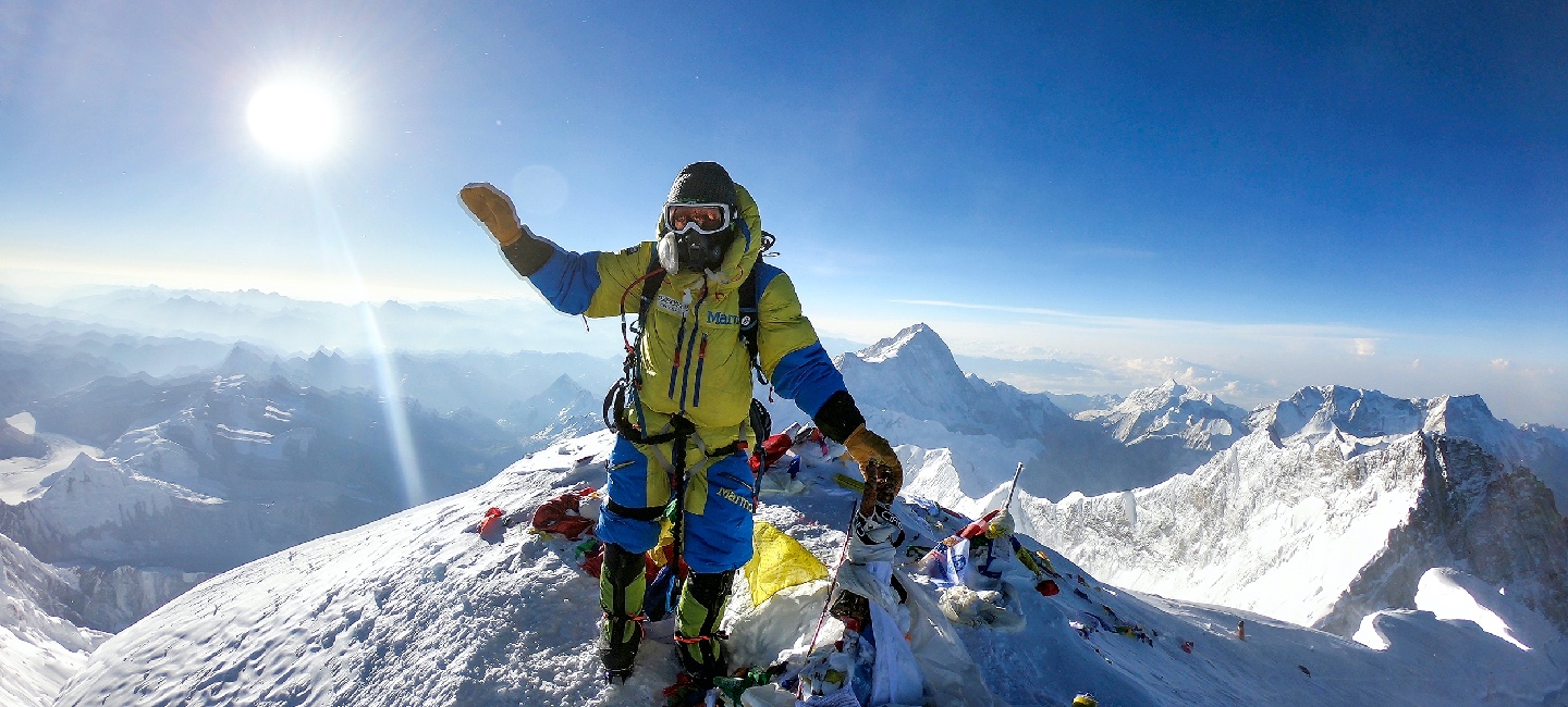
Above the tangle of fixed lines on the 40 foot Hillary step; it’s about 100 meters / 330 vertical feet between here and the summit. But the sheer drop down the Kangshung Face on one side and the South West Face on the other makes this a section of breathtaking climbing both physically and emotionally hard. And the reward, of course, opens up at 8,848 meters / 29,028 feet where there’s no higher step in the world.
We hope to be on the summit in the early morning, with plenty of time to make the long descent to the South Col. After spending another night sleeping with oxygen, the team will descend from camp 4, on the South Col, directly to camp 2 and then, the next day, to base camp.
Here is the oldest monastery in the region which contains what is said to be the scalp and bones of a Yeti, or abominable snowman! Overnight at guesthouse with nice hot shower after a big adventure.
Leaving the mountains behind us our descent takes us through Tengboche Monastery at elevation of 3860meters before continuing back to the town of Namche Bazaar at 3441meters. We arrive back into Namche Bazaar in the afternoon. Overnight at guesthouse.
Finally, we return to Lukla where the trip began, which will seem like a lifetime ago. Enjoying time to reflect on the trek as a group and the personal achievement of all those who took part. Also giving you time to explore the town. Overnight at guesthouse.
Enjoying your last glimpse of the mountains you have recently visited for one last time on the 35 minute Scenic flight back to Kathmandu. On arrival in Kathmandu we are met and transferred back to hotel. Overnight at hotel.
This is also a spare day in case our Lukla flight is delayed. If we fly out of Lukla on time we have a full day to relax and enjoy the various delights of Kathmandu. In the evening celebrate the expedition and as a farewell party to thank the Sherpas and the team member for their support and friendship during the expedition with the hope of seeing you all again for next expedition!
The trip concludes! Today, you can either stay back and enjoy a free day in Kathmandu or leave for your respective countries.
Our representatives will drop you off at the airport according to your flight schedule.