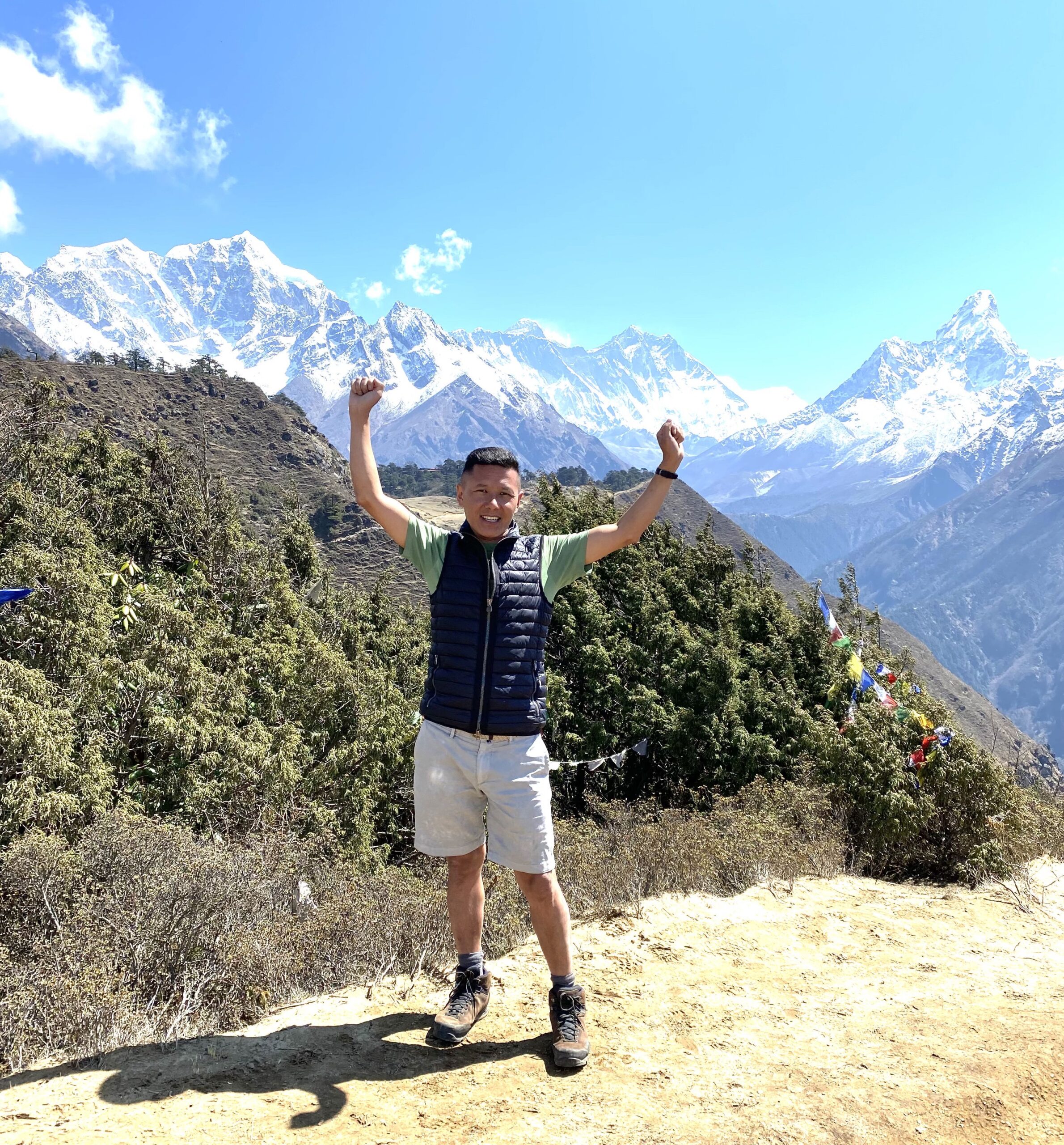
This intimate wilderness Jomolhari trek offers a great variety of trekking conditions, from remote farmland and blue pine forests, to alpine pastureland and breathtaking mountain views. It is an ideal adventure for nature lovers who are seeking a Himalayan wilderness immersion. It’s comfortable, low-impact, and absolutely unforgettable!
From the ruins of Drukgyal Dzong (fortress of the Victorous Drukpas), below such beautiful peaks, you will hike through the heart of wildlife-rich. The sky-piercing peaks, thunderous waterfalls, turquoise lakes and streams, rolling meadows filled with wildflowers, remote yak herders villages, and forests of rodhodendron, pine, juniper and fir provide the perfect backdrop for this inspiring and challenging adventure. You will be rewarded with up-close views of Bhutan’s most beautiful peaks.
Jomolhari Trek Difficulty
The Jomolhari trek is harder than the Druk Path trek as it brings you closer to the high mountains, which means you spend more time at a higher altitude. You will be trekking on good trails but you will definitely feel the effects of altitude as on the first day of the trek you climb quickly above 3,500 m. Saying that on the past day, you will have climbed to the Tiger’s Nest Monastery, which will absolutely assist with acclimatization.
There are a few high passes that are just 5,000 meters shy to tackle; the 4,890m Nyele La Pass and the 4,950 m Yale Pass. Jomolhari Base Camp, where you will spend the night sleeping at just over 4,000 meters, is in the center of these two passes.
Although this is a short hike, a good fitness level will help with the altitude ascents.
Please note that for some nationalities there are restrictions on issuing permits for the Jomolhari trek. Please check with us before booking your trip to see if we can arrange this.
You will be met on arrival and transferred to the hotel. After lunch visit the Paro Dzong and the National Museum, The evening ends with a walk through Paro’s main shopping district. Overnight at the hotel.
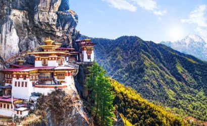
Day excursion of sightseeing to Taktsang Monastery / Tiger’s Nest, the most spectacular monastery and probably the most photographed one in Bhutan, in a way a symbol of Bhutan. It is said that Guru Rinpoche arrived here on the back of a tigress and meditated at this monastery hence it is called “Tiger’s Nest”.
The excursion to monastery’s view point takes about 5 hours for round trip. Lunch will be served at the cafeteria, followed by a short walk back. Evening at leisure. Overnight at hotel.
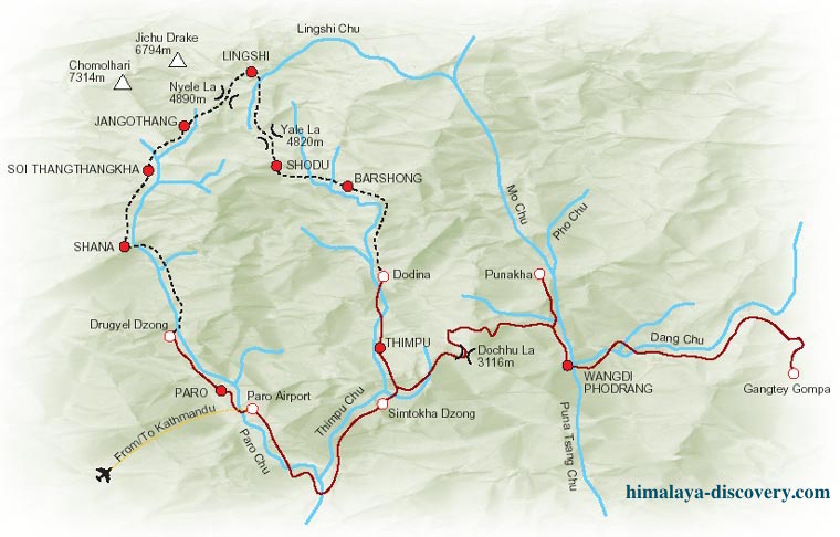
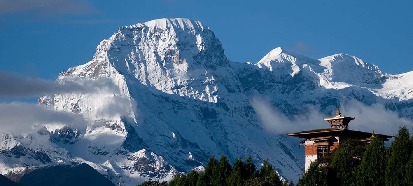
Drive up to Drukyel Dzong (north of Paro) where the motor-able road ends. The ruins of Drukgyel Dzong with Mount Chomolhari behind – a wonderful vista for the start of our trek.
The trek to Shana starts along a dirt road for 1 hour through a wide, rich, cultivated valley, beneath forest-covered mountains, following the Paro Chu (river). Beware of the sun, which can be very fierce at this altitude. The first small settlement encountered is Tsento Zampa, where the traditional Bhutanese farmhouses with bright red chillies drying on their roofs in season. Farmers in this upper valley mostly grow red rice, potatoes and wheat.
The trek continues on the east side of the river, gently through the forests alive with numerous birds and brightly colored butterflies. After 2.5 hours the big military camp at Gunitsawa is reached. The camp has a school and some shops, and your trekking permit will be checked at the camp entrance.
After 20 minutes through forest, you will suddenly see the camp in a big open field at Shana, near the river. Looking back from camp you can see a big snowy peak, Jo Drakey. Altitude of Shana: 2890meters Overnight at tented camp.
Today is a hard day, with a lot of distance to cover. The altitude gain is also above the limit. The trail after lunch is rough and stony with many rises and drops.
Following the river upstream from the campsite we pass old ruins Shana Bridge, destroyed by major flood caused by glacial lake outbursts in 1950’s. This bridge was used in the old days by travelers coming from or going to Phari in Tibet.
The trail climbs steadily through a heavily forested area of oak, rhododendron, bamboo and ferns. After crossing a small house, Shing Karap is reached. Not far after Shing Karap, we pass a junction en-route, where another path leads up the easy, forbidden pass of Tremo La and onwards to the city of Phari in Tibet. This used to be the old trading route.
The trail makes a short steep climb and descent followed by a big bridge at 3250meters, crossing to the east side of the river is Thongo Zam, a possible lunch spot. The trek to Thangthangka continues through the forest consisting of birch, fir, larch, maple and blue pine. After a short climb we reach Seyende Zam where there is a big chorten (stupa).
On clear weather we can see Mt. Chomolhari to the North. Further up about 20-30 minutes until we reach our camp in a meadow. Altitude of Thangthangka: 3575meters. Overnight at tented camp.
After enjoying the view to Chomolhari and breakfast, the trail slowly leaves the forest line and gradually climbs into a beautiful valley, passing Tegethang, a winter home of yak herdsmen. Continuing until we arrive at Jangothang, Chomolhari base camp.
This valley is wide and high with mountains like Chomolhari. Jichu Drake overlooks the camp which is visibly nearby are the ruins of an old fortress. Altitude of Jangothang: 4044meters. Overnight at tented camp.
A rest day at Chomolhari camp to acclimatize. There are some good hikes from Chomolhari camp, and is important to take one hike today. The best walk is towards the East up to the twin lakes of Tsho Phu.
From the lakes there is a spectacular view back to Chomolhari and Jichu Drake Mountains. Watch out for a herd of Himalayan Blue Sheep in this valley, Overnight at tented camp.
After breakfast a steep switchback trail starts climbing out of the valley into another that leads to the final climb and pass. It is a long climb about 3-4 hours to reach the first high and very windy pass of this trek, the Nyelela Pass “sleepy pass” (4890meters).
From Nyelela Pass one you can see far towards the east-northeast into the trekking area that we will be covering over the next couple of days. Mt. Takaphu dominates the view towards the north. Gangchen Ta “Tiger Mountain” is the main mountain to be seen looking east.
Less than 30 minutes down is a flat, more sheltered area – a good lunch spot. We continue to descend passing a narrow gorge with a small river crossing. The trail leads to a viewing point from which Lingshi Dzong can be seen. Our campsite is located next to a river. Altitude of Lingshi: 4010meters, Overnight at tented camp.
An early start as we have a long and a hard day to cross another beautiful pass. We travel through the rhododendron forest on the ridge above camp towards a small chorten (stupa). Below flows the No chhu (Blue river). The climb rises to an altitude of 4450meters and crossing the main river into the side of the valley.
The last part of the climb is through an area with large boulders and several switch backs. After 4-5 hours (after leaving camp) we reach the big cairn on the top of the Yale La Pass (4950meters), with views of the snowy mountains around Lingshi and the Basingthang Peaks.
The descent joins the Jaradinthang Chhu, which becomes the Thimphu River. Following the river until the camp Shodu. Altitude of Shodu: 4080meters, Overnight at tented camp.
In the morning we pass a deserted military camp which follows the trail to the river through the limestone valley. Monks used the caves in the rocks in the old days for meditation.
Cross the bridges over the main river, which offers good views of the giant rock faces and waterfalls. The trail gradually ascends 130meters to the Barshong Dzong ruins.
The Park rangers recorded a tiger and a snow leopard moving in this same area for the first time. You could opt to carry on for 1.5 hour to a better campsite. Altitude of Barshong: 3720meters.Overnight at tented camp.
A steep descent on a rocky trail ending at the Thimphu Chhu river. There are several ups and downs until Dolam Kencho 3290meters. The trail continues up to 3450meters and descends to a side stream and several switchbacks to descend a vertical cliff finally reaching the last stretch to Dodina.
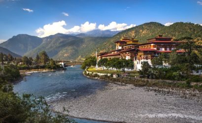
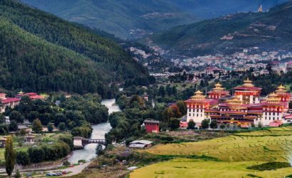
Descending through bamboo forests, following the mule trail high above the river until it finally meets it again at Dodina, where our transport will be waiting to take us to Thimphu, capital city of Bhutan, Overnight at the hotel.
Sightseeing of Thimphu Valley includes the National Library, Traditional Medicine Institute, Arts & Crafts School, Textile and Folk Heritage Museum, National Memorial Chorten, Zilukha Nunnery, Traditional paper factory, Zilukha Nunnery, Takin mini Zoo, Handicrafts Emporium, local shops.
Finally visit to Tashichho dzong which houses most of the Government office and King’s Throne room. Evening depart to Paro. Overnight at hotel.
After breakfast our Airport representative will drop you to the Paro International Airport for your flight departure from Bhutan.